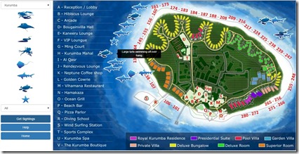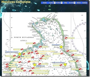
Snorkel Spotter v2.0

Snorkel Spotter 2

Santa left Maldives Complete a big present under the code tree this Christmas – a completely re-platformed “Snorkel Spotter”.

An added bonus is that now you can log your Snorkel Spottings with your iPhone or iPad as these are now supported with the Safari browser.

As I mentioned recently, while I started out on an almost ‘completely’ Microsoft platform (due to where I was working at the time), the Microsoft strategy and execution in the Internet arena has been unfortunately pretty dire. Technologies it heralded as the next big thing were often discarded. The latest casualty of their myopia has been Silverlight.

I built the Snorkel Spotter dynamic control on this platform as it was hailed to be the latest thing for web interactivity. Unfortunately, neither I (still subscribed to too many Microsoft kool-aid newsletters) nor Microsoft saw HTML5 coming down the pike.

From the outset, Silverlight was an aggravation for users who increasingly were using non-Internet Explorer (IE) browsers which required a fairly complex installation of a special plug-in to get the Spotter to work. And last year, Google’s Chrome, the most popular browser of all, stopped support for Silverlight all together (even a plug-in wouldn’t work). So, prospective “Spotters” had to find a machine with IE or try to install it themselves (and often companies like resorts look down their computers and don’t let staff install whatever programmes they fancy, especially those downloaded from the Internet).

Enough was enough and I decided to move to the new de facto standard for interactivity – HTML5. Unfortunately, I had a few other projects in the queue (eg. WordPress Migration, Beauty Base launch). And once spec’ed, it took a while to code and implement. Hats off to .Net developer Tapesh M. from Ahmedabad, India who did the actually code migration for me. Microsoft has been woefully remiss in providing any migration tools or even guidance on moving from Silverlight for HTML5 (I spent a month researching it). Anyone faced with this problem should get in touch with Tapesh. He does brilliant work.

The migration has also given me a chance to clean up a few glitches and update some of the data and maps in the Spotter. I hope that the work makes the tool all the more fun and useful for everyone.

Happy Spotting!

1000+ Dive Sites

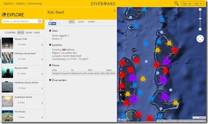
Dive site snap

This week I crossed the 1000 dive site mark – 1077 to be precise. Thanks so much to the many dive centres and marine biologists who have helpful shared their knowledge and material with over the past weeks me to allow me to consolidate it into the interactive platform.

I’ve not just added material, but I’ve also enhanced a number of aspects of the interface as well.  Especially if you are going to be packed with comprehensive information, you need to make it easy to navigate and access.

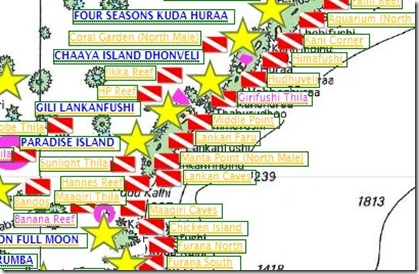
For example, the most common layout for dive site maps on the Internet is to number the dive sites, and then place the numbers on the map and then have a key off to the side saying which dive site is which number. If that wasn’t challenging enough to have to look up everything, the numbers aren’t laid out in any semblance of an order so you are having to hunt and peck to find the location of a specific dive site “Where’s Wally” style. The Maldives Complete maps have interactive labels, so a browser search will take you right to the dive site you are seeking amidst the constellation of choices in front of you on the atoll map.

Some of the V2 enhancements include…

  • Marine Protected Areas – I’ve added all the Protected Marine Areas highlighting both their areas and dive site labels/links found in the MPAs.
  • Profile Link – Version Link from Resort Profiles to Dive Site and to Dive Maps
  • Drill Downs – I’ve added a number of more drill down sections in atolls where concentration of dive sites in certain areas make it too hard to distinguish them at the default zoom. In particular, there are “region” maps for…

A few more fun stats about the dive site population. First of all, here are the most common dive site “types”…

  • Thila – 232
  • Faru – 104
  • Kandu – 92
  • Giri – 67
  • Reef 63
  • Corner – 56
  • Point – 32
  • Channel – 17
  • Rock – 17
  • Garden – 13
  • Wreck – 10
  • Wall – 5

And just as there are more than one “High Street” in England, there are more than one “Kuda Giris” in the Maldives ocean. Sometimes a popular site name is found in multiple atolls, but sometimes a single atoll will have the exact same dive site name in two places (eg. “Kuda Thila” in the North Male atoll). So make sure you know which one you are going to!). The top favourite dive sites names are…

  • Coral Garden – 9
  • Kuda Giri – 8
  • Kuda Thila – 7
  • Bodu Thila – 6
  • Shark Point – 5
  • Aquarium – 5
  • Bodu Giri – 5

My 6th Tour of the Maldives is coming up next week (stay tuned for details) and this trip should help me gather up even more material on dive sites across the Maldives, but especially in the two remote atolls I am visiting.

Best of the Maldives: Equatorial – Ayada

equator

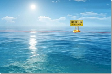
What gives the Maldives its distinctive sunny disposition is its equatorial location.

I remember a story from my junior high geography class where the captain of a cruise liner was being harassed by an obnoxious passenger who insisted on being shown the Equator when they crossed it. So when the ship was approaching the 0 degrees mark, the captain called the passenger up the bridge. The passenger was upset because “on the maps, it is clearly a line across the ocean”. So the quick thinking captain, pulled a long hair from his head, stretched it across the lens of his looking glass and said, “Here have a look…” The passenger saw the thin line of the hair superimposed on the vast expanse of blue and was duly satisfied that he had now seen the Equator.

And if you want the most equatorial adventure that the Maldives has to offer, then you need to go to Ayada. As the southernmost resort in the Gaafu Dhaalu atoll (the resort atoll closest to the Equator) it is your closest opportunity to crossing hemispheres.

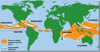
This equator-centric location also bodes well for the Maldives weather. While “tropical” storms tend to start near the equator (with its sunny warm heating the ocean and the air), they rarely end up there. Once they gather a bit of power, then they veer north or south away from the Equator (as the picture below describes) – and away from the Maldives!

Tropical storm formation

Best of the Maldives: Resort Dive Site – Werner Lau (Bathala, Filitheyo, Medhufushi, Kuda-Funafaru)

Werner Lau dive sites

When describing my motivations for adding a Dive Site database to Maldives Complete, I noted the lack of interactive guides. Most diving information is traditional hard-copy book form or magazine websites that provide articles and overviews, but not a structured, interactive resource.

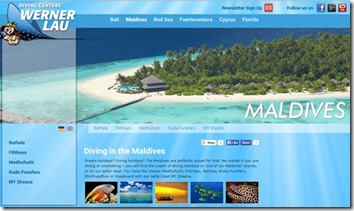
The exception to this standard approach is the Werner Lau dive centre website. They have cleverly integrated a mapping of the dive sites near their centres with Google Maps to provide an interactive layout of all of the dives sites local to their 4 Maldives dive centres. You can scan the area for websites who have ToolTip annotations and then simply click on their names to take you to a full profile of the dive site complete with dive chart.

Dive Sites Complete

Dive Sites Complete

Announcing the Dive Sites database and *Complete* interactive guide.

When I first started Maldives Complete, it seemed like the only information available on the Maldives was for divers and honeymooners. As a result, I veered away from those topics and focused on less catered for subjects like families as well as unusual activities and offerings. I am obsessed with snorkelling and this has brought be closer to the diving domain. Increasingly, however, I am receiving more and more diving enquiries and am finding it hard and harder to find comprehensive diving information in structured, interactive resources.

The primary source for dive site information has been the hard-copy books which are extremely well done. But they add a fair bit of weight to the baggage and aren’t the easiest to navigate. As with the proliferating resorts, one of the biggest problems is being spoiled for choice. There are 100+ active resorts, but there are 10 times that number of dive sites (at least).

The main sources of research have been the following in particular (and the featured dive charts are kindly used with permission and the source is linked to in the profiles)…

And after several months of research and coding (with big help from my ace assistants Emma Barnes and Grace Bolton), I have now scratched surface with a credible v.1 database with over 500 dive sites. Specifically, the new section includes…

  • Number of Atolls covered – 18
  • Number of Dive Sites – 552
  • Number of Dive Charts – 243

Here is the number of dive sites included by Atoll…

  • Baa 31
  • Dhaalu 5
  • Faafu 53
  • Gaafu Alifu – Dhaalu 34
  • Haa Alifu 33
  • Laamu 14
  • Lhaviyani 22
  • Meemu 54
  • Noonu 31
  • North Ari 55
  • North Male 89
  • Raa 3
  • Seenu 16
  • South Ari 44
  • South Male 45
  • Thaa 1
  • Vaavu 22

The exercise has also surfaced some other interested statistical tidbits about the Maldives dive sites (at least the sample set I have at hand)…

  • Resort with Most Dive Sites Nearest: Filitheyo – 53. This stat is primarily down to the (a) great information from Werner Lau who operates out of Filitheyo, and (b) the fact that Filitheyo is the only resort in the entire Faafu atoll so it pretty much has the atoll to itself.
  • Most Common Dive Site Name : “Kuda Giri” – 6. You will see that sometimes I parenthetically appended the atoll name to the dive site name. This was done to make the site name unique since multiple dive sites used the same name.
  • Most Common First name: “Bodu” – 13.
  • Common Type (eg. “Thila”, “Kandu”, “Corner”): “Thila” – 112.
  • Longest Name: “Kanandhou Kaleyge Galha” – 23 letters.

Right now the profiles are quite basic. They include…

  • Dive chart (where available)
  • Atoll
  • Nearest resort
  • Alternative name(s)
  • Features (eg. cave, wreck, creatures)

All of the material is far from perfect.

  • Polish – Not all of the graphics are perfectly aligned/sized/etc. Some people look down their noses at Maldives Complete’s rough hewn design. It stands in stark contrast to the slick (and all too often useless) websites of many resorts. I’ve resisted exhortations to “polish” the site with a glossy look and feel. I have neither the money nor the graphics ability to do so really. Furthermore, I have bit of aesthetic preference for the simpler layout and style. I prefer to think of it as “artisinal”. J
  • Precision – I toiled for a long time at the outset about the degree of granularity to have in the interactive map. Zoom in and you can’t get a sense of everything at an easy glance. Zoom out and you can’t get precision or a sense of the surrounding area. I think I got the balance right in the end, but if anything I ended up sacrificing precise placement of dive flags for ease of at-a-glance navigation. You can drill into very close-up looks at the dive areas and their topology using the British Admiralty map DeepZoom feature of the site.
  • Completeness – Help me! My aspiration is *complete* and I am aware that I have rippled the surface of dive sites and information about them. If you would like me to add a dive site or materials about one already included, please contact me.

I may extend the profiles to more information if (a) there is demand from website visitors, and (b) there is help from local resources to supply the information.

Which brings me to the final points. I have a number of principles that guided the development of Maldives Complete, and those have led me to not just adding dive site information, but *how* I added it…

UNIQUE – First principle of Maldives Complete is to only add data and functionality you can’t get elsewhere. I follow Seth Godin’s marketing precept, ‘Don’t be the best one, be the only one.’ If someone else has the information or material, then best just to point to that rather than add a “me too” capability (and the profiles point directly the top dive resources on the web to help people find more detail about those dive sites at the web sites that focus in on them).

The interface for the material is a uniquely interactive map of every atoll. The other dive maps (eg. MondoMaldive, Maldives.at, Werner Lau) don’t cover ALL the atolls. They cover about a half dozen atolls. Maldives COMPLETE has 18 of the 22 main atolls (and I will be doing research to get dive site locations for the other 4 over the next few months).

Also, the existing dive site maps use a numbering key which means that you have to reference the name at the bottom which is all a bit cumbersome.

I’ve also based the catalogue on the British Admiralty Maps which provide comprehensive topological information and a range of depth measurements. All of the other maps are a simplified atoll layout just showing the islands. The maps also have the added advantage of being consistent with the longstanding Maldives Complete feature of the “Deep Zoom” map which allows people to examine certain areas with great clarity and detail.

UTILITY – For everything I add to the website I ask, “Is it useful?” As a result, I didn’t add a number of pieces to the Dive Site information that I could have. For example, I have passed on…

  • Pictures – Some dive site guides have pictures taken from the sites. But frankly, they are all close-ups of various fish and features that could be anywhere.
  • Depths – Frankly, the vast majority of the Maldives dive sites are all between 5-10 meters going down to around 20 meters. It didn’t seem worth the effort to catalogue the minor variations and few exceptions. Star rating
  • Ratings – These vary but include overall quality of dive, sometimes a special rating for snorkeling, or sometimes a difficulty rating.
  • Visibility
  • Descriptions
  • Accessibility

USER-SUPPORTED – The best part about Maldives Complete is the extensive support I get from fans around the world you appreciate it and help plug gaps in data and information. A good chunk of my “Best of the Maldives” features are nominated by readers and most of the few percent of pictures I am missed are supplied by guest. I am hoping that dive centres, marine biologists and supportive guests will help me build the catalogue especially with the addition of dive charts.

(I guess one could say that it’s all about yoU !)

Best of the Maldives: Snorkelling Guide – Jumeirah Dhevanafushi

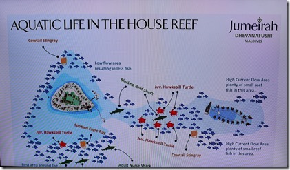
Jumeirah Dhevanafushi - reef plan

On Groundhog Day today, I hope you spot more than your shadow in the Maldives. My whole Snorkel Spotter development stemmed from wanting more help for guests to know where to focus their hunting. Before I came up with it, I always suggested that the resorts post a white board with maps of the house reef so people could mark where they had seen different things (old school “Share”).

Jumeirah Dhevanafushi has come the closest to the digital sophistication of such a house reef guide. Their in-room IPTV offers a channel with an “Aquatic Life in the House Reef” guide (see above). It provides helpful tips about current as well as the creature most regularly spotted and where.

Who says there’s not point to watching TV in the Maldives?

Best of Maldives Online – Wind Info: National Renewable Energy Laboratory

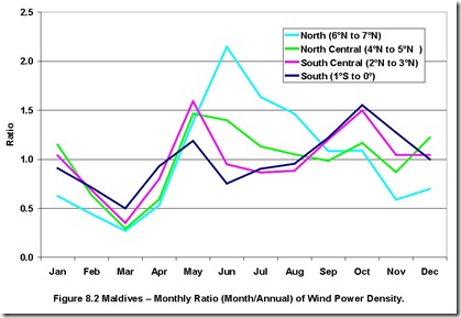
Maldives wind by month

One of the most popular posts on Maldives Complete and frequent topics on the TripAdvisor Maldives Forum concerns the best times of year for sunshine. Despite all of the spousal-celebration, scenery, snorkelling, surfing, super-deluxe, the “S” that is the Maldives’ first and foremost allure is the sunshine. Being an equatorial destination, the fact is that pretty much all of the Maldives is sunny and warm pretty much all of the time. Sure, there are bad days and there are a few times of year (eg. January through March) where the sunshine is uncannily persistent. But when people are shelling out for the life of a lifetime, they will split hairs on the securing just the best weather possible (mind you, I maintain that going to such obsessive lengths can lead to major disappointment if you catch some simply bad luck).

People always ask about the sunshine (or its other-side-of-the-coin, rainfall). They also ask about temperatures (air and water). But you don’t get many enquiries about the wind. Actually, the wind, or in most cases “breeze” really, can have as much of an impact on the climate as precipitation and temperature…

  • Too much breeze…
    • kicks up the water stirring the sand and reducing the crystal-clarity of the waters for snorkelling.
    • limits romantic beach dining as sand gets blown into food, candles get blown out and table items get knocked over.
  • Good breezes …
    • hit reefs from the right direction drive currents into them for world-class surfing.
    • off the water on a toasty day is that perfect cocktail of warmth and cooling.
    • power great sailing, windsurfing or kite surfing. Comparing the prevailing winds to the location of the water sports center might optimise your fun if this activity is a big priority.

Guests also enquire about “sunset” or “sunrise” depending on whether they like to savour their daily solar ritual with a coffee or a cocktail (sunset is more popular by far). But the wind equivalent is “leeward” versus “windward”. Though this distinction changes with the season. In fact, the “monsoon” seasons are characterised by the shifting of the winds from one direction to another. So a leeward villa one part of the year will likely be windward another time.

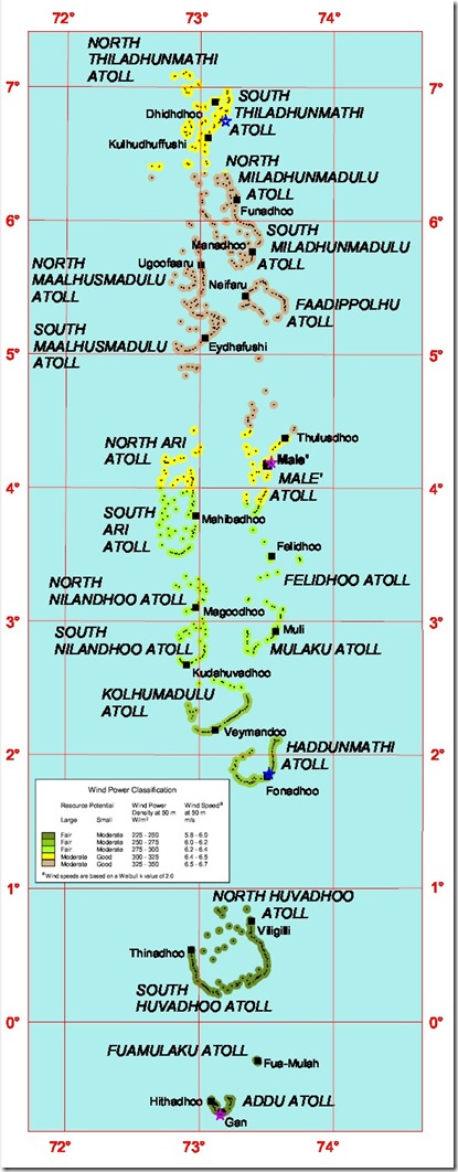
So depending on whether you want a wafting or calm, you might want to check out the best resource on Maldives breezes, the “Wind Energy Resource Atlas of Sri Lanka and the Maldives

For more real time indications, you can also check out the Wind Finder website which includes up-to-date tracking of Maldives conditions.

Maldives Wind Resource map

Best of the Maldives Online: Island Status Map – IslandsOfMaldives.gov.mv

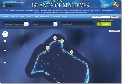
Islands of Maldives


The whole mission of Maldives Complete is about easy to understand and access information. Maps are a great way to literally visualise the landscape of this paradise. So Maldives Complete has always been a fan of good maps like…

This week the Ministry of Tourism launched a handy resource where people can interactively explore the status of all of the Maldives islands in any atoll. This not only provides an up-to-date status on current resorts, but also provides the most comprehensive and easily accessible catalogue of upcoming projects.

Best of Maldives – Online: Interactive Map – Dreaming of Maldives

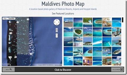
Dreaming of Maldives interactive map

Like the resurgent corals, the vibrant inter-web thingy just gets richer and more colourful every day. When I launched Maldives Complete, there was a really dearth of good, useful information about the resorts. The resorts themselves had weak and limited websites. Nowadays, things are much more sophisticated.

Probably my second favourite Maldives website, after Maldives Complete, is Sakis Papadopolous’ ‘Dreaming of Maldives’. Just as I started with an anchor of a comprehensive database, Sakis’ starts with simply the best collection of images on the Maldives around. But like Maldives Complete, he hasn’t rested there and has branched into a range of other areas. His section on families, “The child-friendly Resorts in Maldives, all the Kids-clubs,’ remains one of the most comprehensive reviews of resorts on the Maldives. He has started to move into videos with dazzling results. And his latest innovative addition is this ’Maldives Photo Map’.

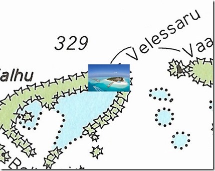
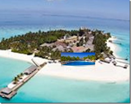
When I first launched Maldives Complete, one of the fun bits I added was the DeepZoom control of the British Admiralty Maps of the country. As I launched it, you can zoom into the charts to exacting detail. I had fantasized about pushing this party trick even further. I had pictures for both aerial shots of the island and prominent features like the swimming pool. I had thought that once one zoomed into an island, you would see an aerial photo (see directly below). And if you zoomed in on the photo, then it would take you to a shot of the pool (see bottom). A bit like a Russian doll photographic drill down reminiscent of the second half of the iconic film, ‘Powers of Ten’.

In the end, I didn’t see a lot of traffic on my interactive map and Microsoft never really developed the Deep Zoom technology much. Its editing tool, Deep Zoom Composer, remained klunky and incomplete. So I decided it would be too much work to add these extra layers of images. Also, soon the Google and Bings maps caught up on the imagery and so the aerial shots were pretty good. And now Sakis has taken the final step of allowing you to zoom even closer into gorgeous shots of island highlights.

Velassaru deep zoom island

Velassaru deep zoom pool

Lightest Place on Earth

ESA GOCE gravitational data

Here is a post with a little less gravity. Literally. (thanks Adrian).

All Maldives aficionados know that there is something special about the Maldives. Something unique about its landscape and topology that is simply not found anywhere else on the planet. It turns out that such distinction might extend beyond the expansive lagoons and mottled turquoise reef waters.

The European Space Agency (ESA) recently published findings from its pioneering GOCE (Gravity-Field Ocean Circulation Explorer) satellite measuring the gravitational field of the Earth. As the map above shows, the epicentre of the lowest gravity point on the planet is focused right over the Maldives.

My wife Lori and I joke how after a hard day’s work it seems as if someone must have turned up the gravity-thermostat in our house, because getting up off the couch seems to be as hard as jumping on Jupiter (and looking at the map, it seems that we weren’t too far off with our paranoia since in the UK since a large orange blog of extra strong gravity is looming right next door in the North Atlantic…my hypothesis is that this blob of extra gravity shifts on top of our house every Monday morning().

If you are thinking that this gravitational void is going to get you off the hook from multiple trips to the buffet, be aware that these variations in the gravitational field are quite minute and take sophisticated scientific equipment to detect (a sophistication that your bathroom scale is not likely to have).

But if you want to feel light on your feet, or have that ‘floating’ feeling (even on land), the Maldives is scientifically proven to be the lightest place on the planet.