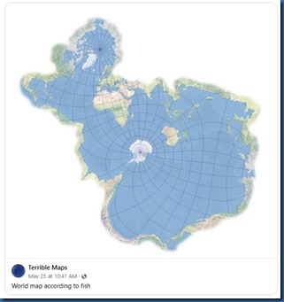
I long been an a-fish-ionado of maps to provide a range of creative visualisations to guide humans, but someone has thoughtful crafted this cartographical guide for our piscatory residents and passers-through.
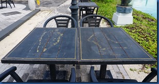
Best of the Maldives: SAii Lagoon / Hard Rock – Map Table
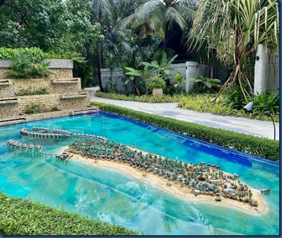
Best of the Maldives: Resort Model – OZEN Reserve Bolifushi
Instagram is full of models posing in the Maldives, but this has to be my favourite of all (thanks Paola). I love maps especially Victorian birds-eye perspectives. A scale model like this on at OZEN Reserve Bolifushi is a superbly detailed birdseye map rendered in 3D that provides a uniquely effective “at a glance” perspective on the property.
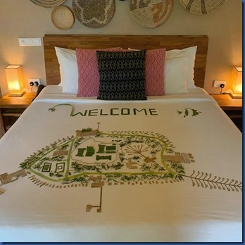
Best of the Maldives: Bed Decorating Map – Bathala
Like the famous (well, in America) Reese’s commercial, “two great tastes in one”. Two of my favourite decoration motifs are (a) maps, and (b) bed decorating. Bathala has combined both for this striking creation.
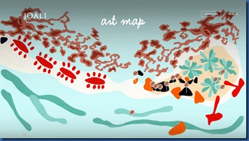
Best of the Maldives: Art Map – Joali
For many maps are quite practical items, but I’ve always been captivated by their aesthetics. Capturing a sliver of the world in a useful snapshot from a birds eye view. No surprise that the art immersion resort of Joali even turned their creative eye to a map of their art collection. How apropos that the map of art installations be a work of art itself.
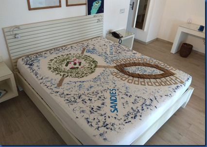
Best of the Maldives: Bed Decorating Map – Kudafuhi
Two of my favourite features – island maps and bed decorating. Both are quite distinctive in the Maldives with their “all on one island” resort properties and their tradition of elaborate blossom bed creations. Kudafushi has merged the two together for a mattress-based map of the island’s landscape (thanks Paola). One of the most exquisite works of bed decorating I’ve seen.
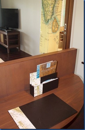
Best of the Maldives: Map Theme Decor – Hurawalhi
Something about a map that has detailed artistry and exotic allure. It tells an aerial pictorial story of some part of the planet. Ocean maps are often the most enchanting with their sinuous coastlines and patterns of inlets and isles.
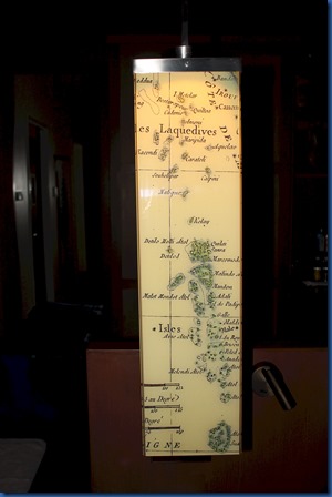
Naturally, maps of the Maldives are bursting with this adventurous charm. Huawalhi has a employed one of the more antiquarian depictions of the “Laquedives” as a design highlight in its villas. Blotter, cases, lampshades, etc. use segments of these ancient charts. Very reminiscent of one of our favourite designers, Alviero Martini’s “1ª Classe’ line of fashion and accessories.
Best of the Maldives Online: Interactive Weather Map – Dark Sky
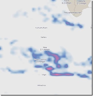
National Geologic Map day is just the time to share one of my new favourite sites. – Dark Sky. I’m a lover of visual representation of data (bit of an Edward Tufte groupie). Dark Sky brings together two of my favourite tools – maps and interactivity. To help share updates on everyone’s favourite topic (and often top reason for going to the Maldives) – the weather. In fact, all of my interactive graphical features on Maldives Complete are map based – Snorkel Spotter, British Admiralty Maps DeepZoom (needs IE unfortunately), and Dive Maps. The Dark Sky site is very high quality and aesthetically well done with lots of weather data.
In honour of Geologic Map Day, I have added the “Maps” tag to the blog.
Happy exploring!
Best of the Maldives: Links Golf – Shanrgi-La Villingili
“Golf is a good walk spoiled” – Mark Twain
And if you are going to “spoil” your walk, you might as well make it a great one along the coastal beauty of Maldivian paradise. According to Shangri-La Villingili (and I haven’t been able to find any examples to contradict them), their 9-hole golf course is the *only* course in the world where *every* hole is on the ocean. Of course, Scottish links are the world showcases for links play, but even the legendary St. Andrews only has its front nine on the ocean (the back nine returns inland).
I love it when Maldives resorts push their activities out to the ocean. For years, the “activities” (eg. spas, fitness centres, sports areas) were sequestered in the middle of the island. I guess this made use of this interior and they figured that people would be so busy doing their thing that they wouldn’t need breath-taking views. But the whole point of doing these activities on holiday in the Maldives is to enjoy them *with* the bonus of the enchanting ambiance. Now, the top properties put their spas and gyms and other activities right on the water which lured people to the destination in the first place.
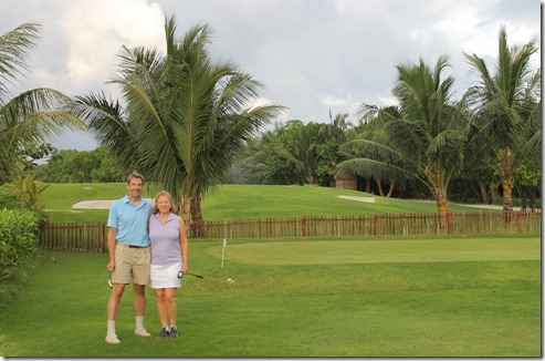
During our Tour visit to Villingili this summer, Lori and I actually got to play a proper round of golf on this distinctive course. As I noted in my tour report, it might be just a par 3 course, but it is still a serious course – seriously laid out, seriously challenging, seriously beautiful surroundings and seriously fun. Not our best round of playing (see Twain quote above), but certainly one of the most spectacular rounds we’ve ever played.
The course does require a very precise approach game as the fairways are narrow (limited real estate) and unforgiving (eg, the big, blue ocean looming to the right of every shot). Elite golf these days is all about the approach. Everyone on Tour can drive plenty far enough with accuracy, but the birdies are made on heroic approach shots landing close to the pin or heroic putts from further away from the pin (and the former are a bit easier to achieve for a pro).
Also during our stay, I had a chance to meet one of the course designers and architect, Kai Smit, and ask him a few questions about this Olympic calibre course. As the Rio Games finish up today (including the first ever Olympic Golf Tournament), here is an in depth look at Maldives’ own tropical golf course…
• What was the inspiration to build a golf course on such limited space?
The southern tip of Villingili Island was undeveloped and the location where the Project Contractor Dormitory was located. This parcel of land was also the logistics centre for materials and equipment that had to be imported to construct the Hotel. It also served as a centre for project waste collection before shipped off the island. The Challenge was twofold, namely 1) to restore the natural habitat and environment to be consistent with the rest of the Island and 2.) try to introduce a value added recreational activity for Resort Guests without harming the environment. The orientation and scale of the peninsula lent itself to be a superb 9 hole – Par 3 Golf Course. Providing a pleasant walk at Dawn and Dusk. All Golf Holes could be routed alongside the ocean, creating 9 greens next to water and ensuring that when playing at dawn or dusk – the players did not look into the sun on the first five outward holes and the last three inward holes. The only hole that the player may look into the sun at Dawn is the signature 6th Hole that faces eastward – and what a sight that can be!
• What was the biggest challenge to building the course?
The limited supply of sand and elevation of the land . Neap tide also presented some challenges as the course is low lying and the eastern shoreline on the peninsula can experience some rough sea conditions.
• What is your favourite hole?
The signature 6th Hole with the ocean backdrop of breaking waves.
• Any tips for playing for course?
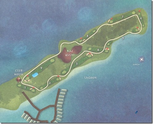
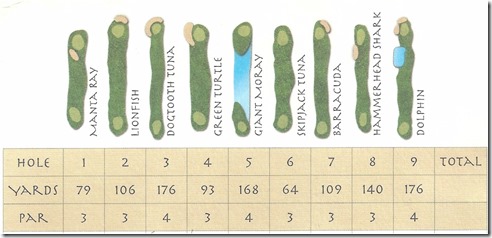
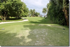
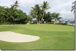
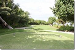
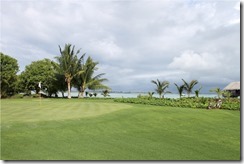
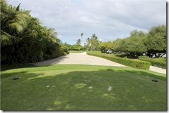
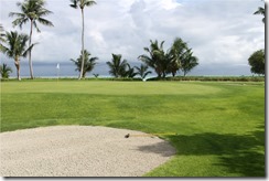
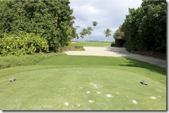
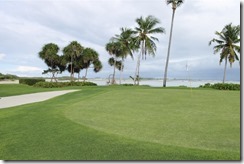
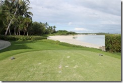
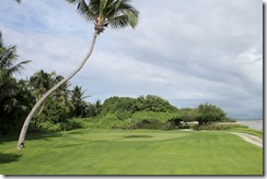
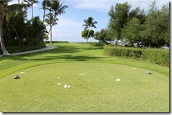
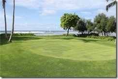
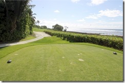
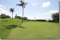
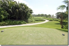
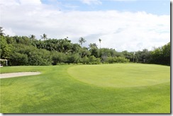
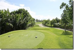
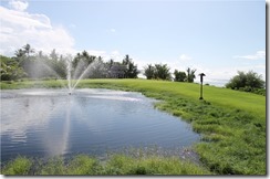
Ensure that you have enough golf balls and stay out of the ocean. Generally, the course favours the player hitting a draw as opposed to those players who like to shape the shot from left to right. Below is a photo tour of the course with the overall layout map directly below, with the individual hole layouts below that. Then following is each of the (a) tee shot views, and (b) green views.
Clubbing at its best!
(click on picture for a zoom in)
Best of the Maldives Online: Interactive Dive Map – Dive Board
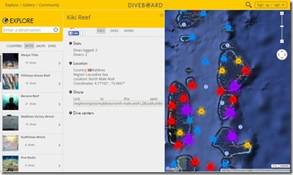
Another site making use of Google’s array of online mapping tools is the Dive Board website. It calls itself the “the largest online logbook” providing a database of dive sites around the world. Users can register and log their own dives on the website. Each dive site has a short profile including such information as Dives logged, Longitude and Latitude, and pictures.
But the real power of the site is how is has integrated with Google Maps complete with drill down functionality. At a “high” level, you can scan an entire atoll and it will show you some markers for individual dive sites. But in areas with lots of diving, it will have a coloured circle and a number both indicated the number of dive sites in that sub-area. If you then zoom in, the map will display further discrete dive sites, or even more circles indicating where you need to drill down further in order to distinguish the sites’ specific location. I love the elegance of this solution. You get high level scan-ability as well as drill-down detail. This capability was one of the great benefits of the Microsoft Deep Zoom technology that I originally exploited for the British Admiralty Maps.
I appreciate the importance of drilling down in making the Maldives Complete Dive Site database. That part of Maldives Complete also works with a basic amount of drill down. There is a top level overview of all the Maldives allowing a user to choose their atoll (most people stay within a certain atoll when visiting a diving. The Atoll view which shows all of the sites in an atoll. You can squeeze them into a PC screen-sized map half the time, but the other half, denser sections of the atoll require a sub-area drill-down map.
