Snorkel Spotter v1.0

Snorkel Spotter

How about an entirely new form of social media designed just for the Maldives?

Introducing ‘Snorkel Spotter’.

Snorkel Spotter is something I have dreamt of for a long time. It was inspired by my experience at Maldives resorts where snorkelling is so popular and the most common question around the bar at night is ‘what did you see today?’ The question is not just marine curiosity and nor merely making conversation, but it is helpful reconnaissance into where one might decide to snorkel on your next outing.

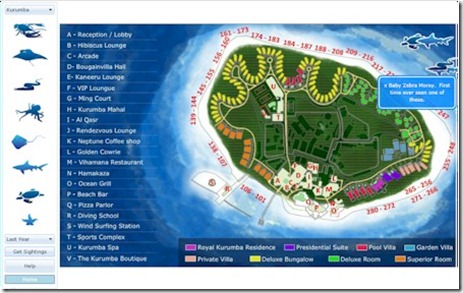
I often suggested that resorts put up white boards at reception with a map of the island where guests could make a public note of what they had seen that day. Since no one took me up on it, I decided to create a virtual whiteboard. Sort of ‘Foursquare for Fish’ as one digerati put it.

If you want to add some sightings, you simply drag and drop the sea creature you saw from the menu at the left to the place around the island where you spotted it (use ‘Starfish’ for ‘all others’ of anything spotted you want to mention that is not included in the standard menu). A small pop-up will show allowing you to make a comment or add (optional) contact information.

If you want to see some spottings, then select Kurumba or W Retreat where I logged some of the sightings my wife and I made during out visit last summer. Also, a beta tester ‘Aurore’ logged a couple of sightings for Sheraton Full Moon and W Retreat as well.

It’s just version 1.0 so it might not be perfect. I have a number of planned enhancements and suspect that once people start using it, other improvements will become evident. Feel free to contact me with any suggestions or problems.

Happy Snorkeling!

Best of the Maldives: Online Official Resort Mapping – Maldives Department of National Planning

Department of National Mapping

Maps are a big thing for Maldives Complete. When you have 100+ resorts on a 1,192 islands a map is pretty critical. And the unique topology is one of the things that makes the Maldives a front runner contender for the ‘Seven Natural Wonders of the World’. One of my highlights of any trip to the Maldives is when the airplane finally arrives in Maldives airspace and the dappling of stunning blues start to appear in the ocean below.

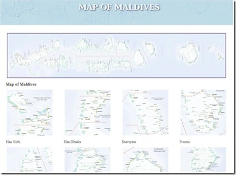
Maldives Complete already features both Bing maps and resort maps on each resort profile as well as a unique ‘Deep Zoom’ version of the classic British Admiralty charts. Now, thanks to Francis Negrin once again, I have another to share.

The Maldives Department of Planning has posted its official atoll maps accompanied by an official resort listing on the web. Since Francis highlighted it to me a while back, I have found it extremely useful as the definitive source on resort status, names and geo information.

As Francis commented, “this collection of maps is amazing and the only worthwhile maps of maldives I have ever seen. it shows all the existing resorts with real and current commercial names shown in blue, and also in blue are all the islands set aside for resort development . It makes it easier to then go on google earth to see what the islands are like from above, or search the internet for news about new resorts opening (an otherwise quasi impossible task)… or to see what uninhabited or inhabited islands are near certain resort islands etc. and it is relatively up to date (2009).