The whole mission of Maldives Complete is about easy to understand and access information. Maps are a great way to literally visualise the landscape of this paradise. So Maldives Complete has always been a fan of good maps like…
- British Admiralty Deep Zoom of not just the islands, but the varying lagoon and ocean depths
- Snorkel Spotter interactive/social map of house reef
- Dive Maps and Charts for each resort profile
- Satellite online maps from Bing
- Satellite weather maps
- Interactive picture map
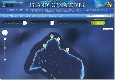
This week the Ministry of Tourism launched a handy resource where people can interactively explore the status of all of the Maldives islands in any atoll. This not only provides an up-to-date status on current resorts, but also provides the most comprehensive and easily accessible catalogue of upcoming projects.

